IWC conducts operations across northeastern Guatemala. While we are active in the departments of Alta Verapaz and Peten, our focus is our namesake: the department of Izabal. (A department is a political unit comparable to a province or canton).
Izabal’s name is of uncertain origin. Some speculate it may refer to important landmarks of the pre-Hispanic Mayan kingdoms. Peten Itzá, a lake situated in the heart of the ancient Itzá people’s homeland, means “enchanted waters” ¹. The word may be a contraction of Itzá (waters) and Bal (lowland), a nod to Lake Izabal, another majestic body of water situated to the south at the headwaters of the Rio Dulce. Alternatively, it could derive from the Basque word Zabal, meaning “wide,” a reference to the lake’s expansive size (it measures 48 kilometers in length and 24 kilometers in width). This explanation is also plausible as many Basque speakers served in the Consulado de Comercio, an institution charged with administering Guatemala’s colonial trade on behalf of Spain’s monarchy ². Both interpretations reveal nuances of the region’s past at the intersection of diverse cultures, migration and commerce. The Izabal department is situated in northeastern Guatemala. It hosts the nation’s main Caribbean deep-water Port of Santo Tomás de Castilla. To the north, it borders Belize and, to the south, Honduras.
 Izabal’s population is highly diverse. While predominantly comprising Ladino people of mixed Spanish and indigenous descent, it’s home to a significant indigenous population, mainly Maya Qʼeqchiʼ. Izabal’s coastal areas form part of the homeland of the Garifuna, a people of mixed African and indigenous ancestry.
The Castle of San Felipe de Lara was built in 1652 on the junction between Lake Izabal and the Rio Dulce to protect the Spaniards’ settlement and trading post from frequent pirate attacks. The fort was used through the end of the 18th century. It was restored in the 1950s and is now a national landmark.
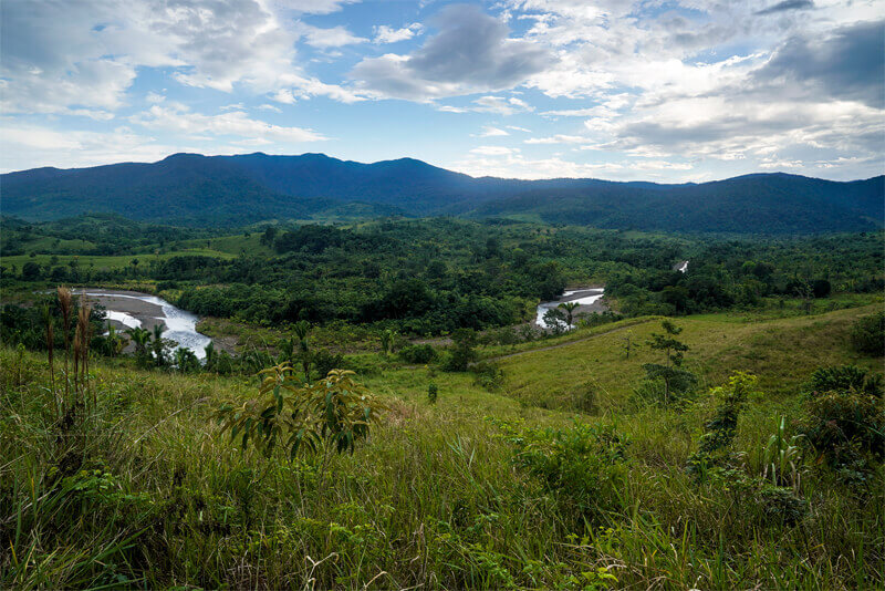
Lake Izabal is Guatemala’s largest body of fresh water and Central America’s third. The lake is fed by the Polochic River and drains eastward along the Rio Dulce into Amatique Bay on the Caribbean Sea. Manatees, while in decline, are still seen in its waters. Fresh-water sharks and sawfish have been documented in the lake’s unique marine ecosystem. Dolphins can regularly be spotted across Amatique Bay where Rio Dulce meets the Caribbean Sea. Mesoamerican Biological Corridor. Although there are several cordilleras in the department rising as high as 1,200 meters in the case of Cerro San Gil, the majority of the land mass is below 100 meters above sea level.
The soils of Izabal are generally not highly fertile for agricultural purposes, originating mainly in limestone with high clay content. Other areas contain sedimented fine clays deposited from major river systems flowing to the Caribbean. Nonetheless, it was a region of intensive cacao cultivation along its fertile river valleys before and into the colonial period. Isolated remnants of pure Criollo cacao can still be found.
Due to its proximity to riverine transport and ocean ports, Izabal’s forests have suffered elevated rates of deforestation and degradation. Once one of the richest reservoirs of big-leaf mahogany, Spanish cedar and Honduran rosewood, much of its precious timbers were felled and sold on international markets.